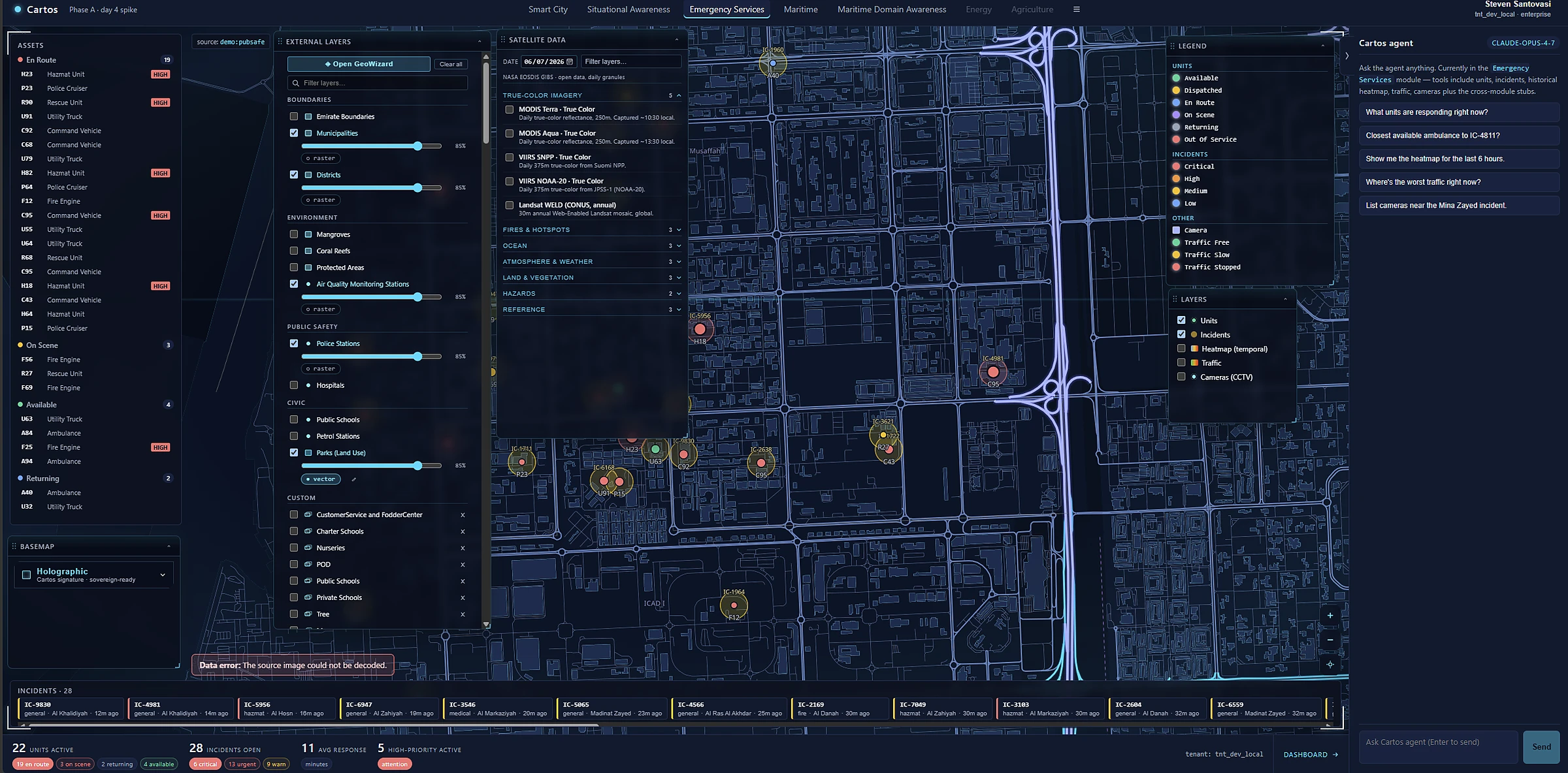
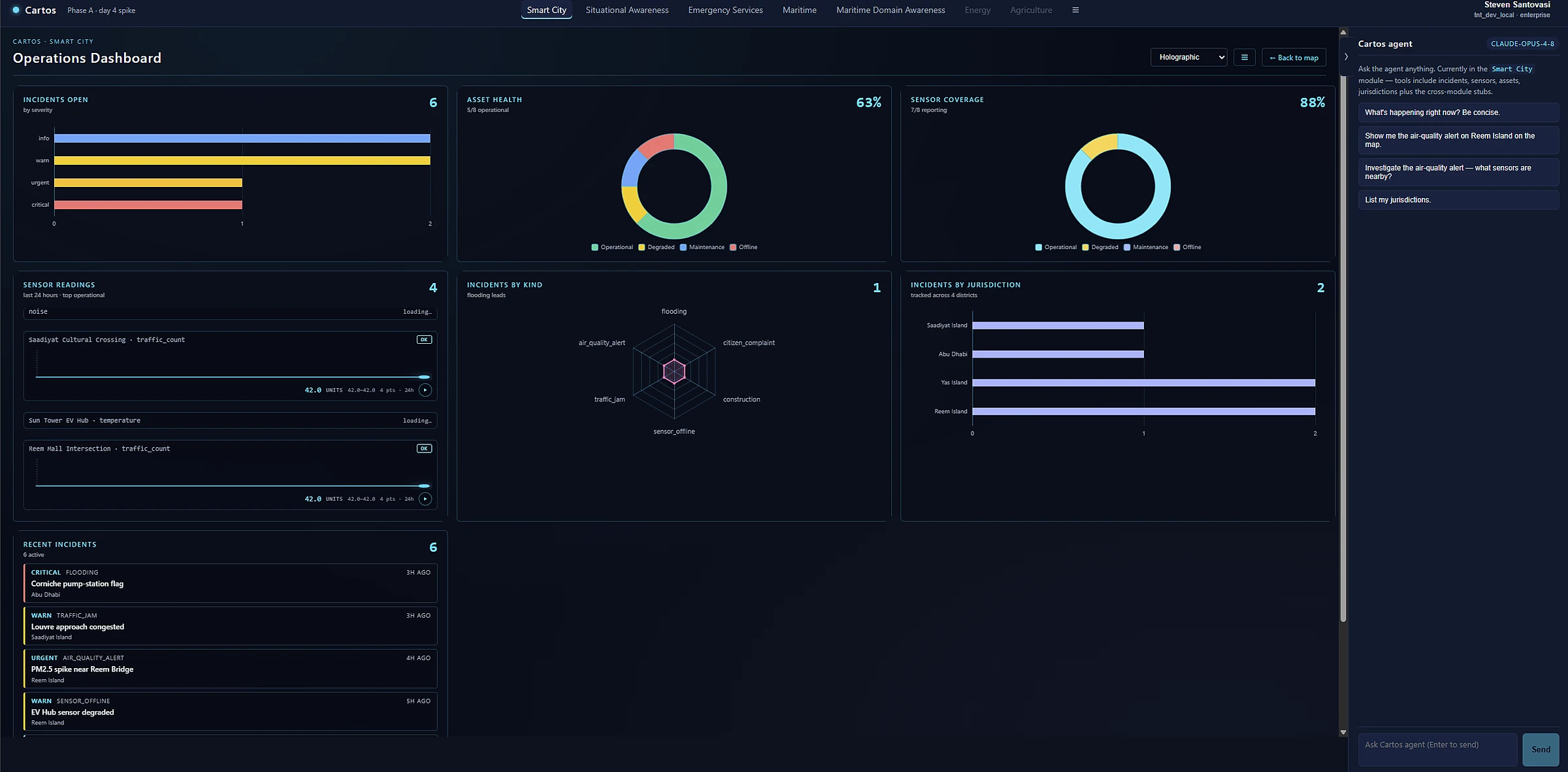
| Emergency Mgmt & 911/999 | Emergency Services | Ops-Center Commander · Dispatch Supervisor | Live incident common operating picture, dispatch, response-time analytics | Local–State | Consolidate CAD + BI; cut response time |
| Police / Law Enforcement | Situational Awareness · Smart City | Crime Analyst · Watch Commander | Hotspot & camera fusion, pattern-of-life, 3D event reconstruction | Local–Federal | Analyst hours saved; faster casework |
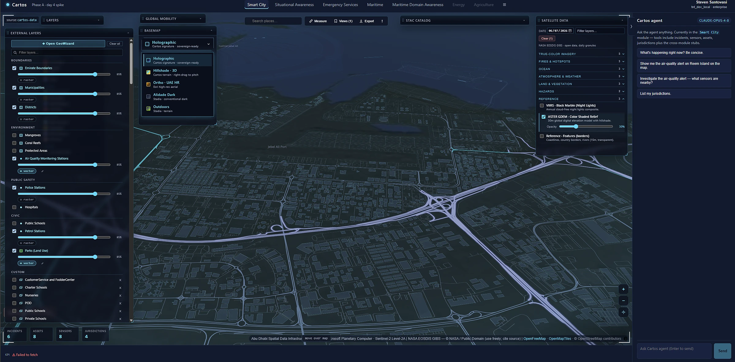
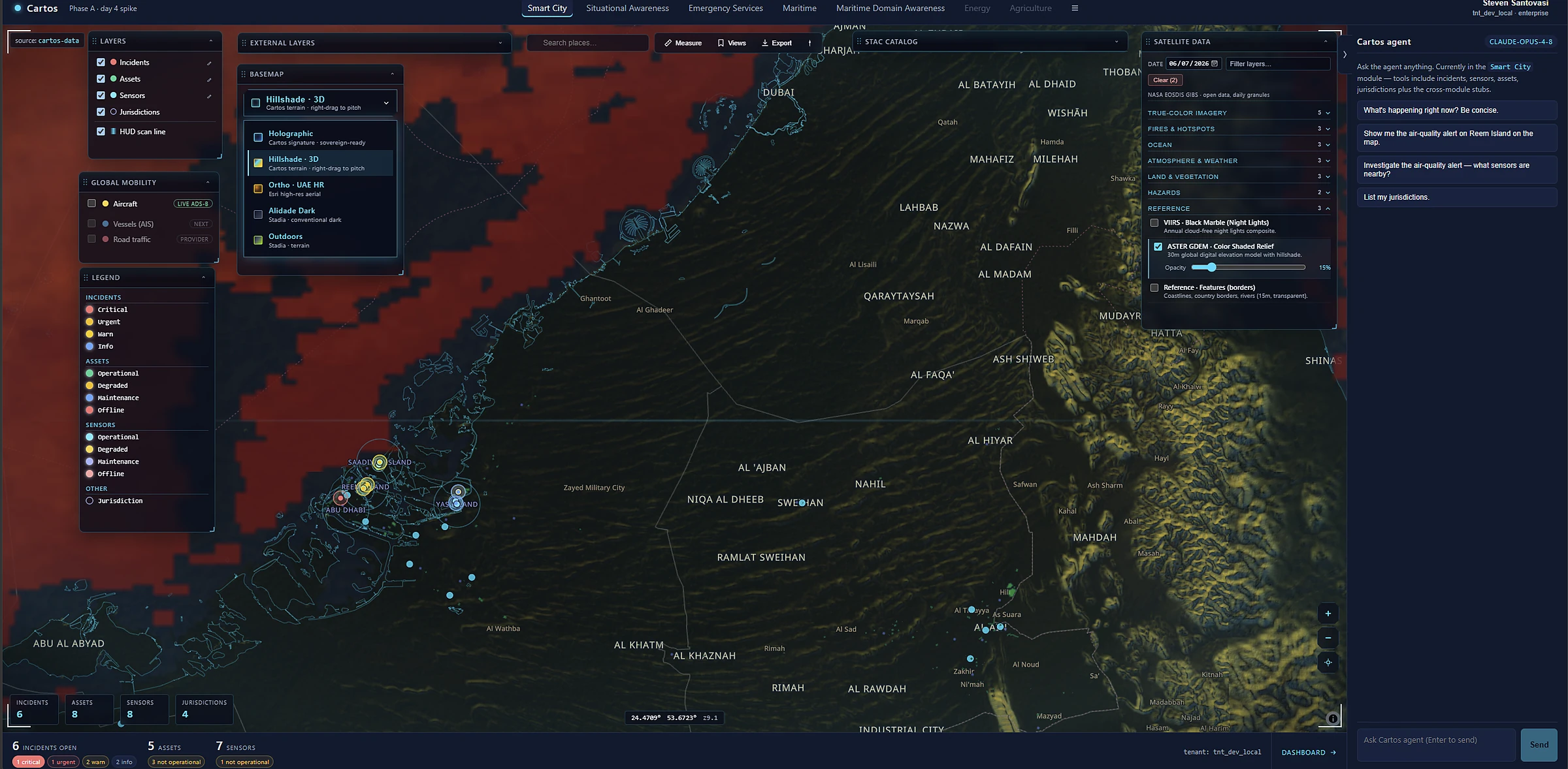
| Transportation & Public Works | Smart City / Mobility | Traffic Ops Manager · City Engineer | Network & mobility monitoring, asset condition, congestion corridors | Local–State | Asset-lifecycle savings; congestion mgmt |
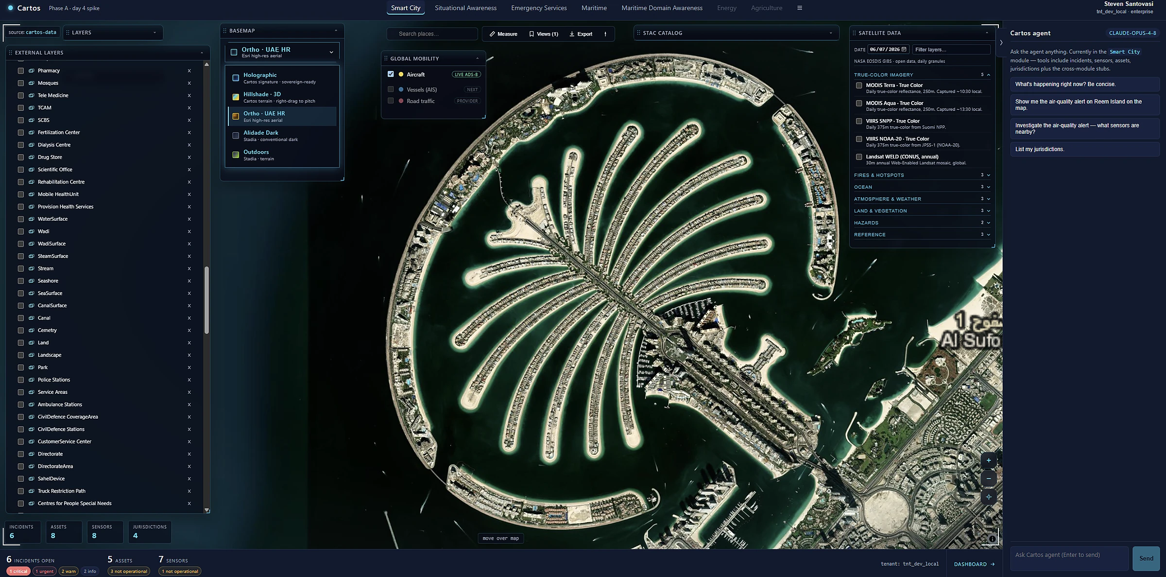
| Urban Planning & Municipality | Smart City + Analyst Layer | City Planner · GIS Director | 3D city models, change detection (illegal builds), permitting base map | Local–State | Catch unpermitted change; faster planning |
| Ports & Maritime Authority | Maritime · Maritime Domain Awareness | Port Ops Director · MDA Analyst | Vessel tracking, port incidents, wide-area domain awareness | State–Federal | Throughput & safety; sovereignty |
| Environment, Water & Agriculture | Analyst Layer (change / environmental) | Environmental Analyst · Ag Officer | Vegetation & coastal change, crop & water monitoring from owned imagery | State–National | Program outcomes; subsidy targeting |
| Defense, Intelligence & Border | Situational Awareness (sovereign) | Intelligence Analyst · Border Ops | Sovereign 3D COP, change detection over AOIs, field ground-truth | Regional–Federal | Sovereignty mandate; mission tempo |
| Civil Defense & Disaster Mgmt | Analyst Layer + Cartos Field | EOC Director · Field Coordinator | Pre/post-event change, damage assessment, field capture | State–Federal | Faster damage assessment & aid |