The Sovereign Platform
Ingest, serve, and visualize geospatial data in a sovereign deployment, with an AI agent wired in. Running live vertical operations today.
Live nowExplore Phase I
SPACE42 · SMART SOLUTIONS
GIQ Atlas is Space42's vertical-AI geospatial platform. It runs live operations on data you own, reasons about change and builds in 3D, and reaches the ground through a sovereign mobile field edge — one platform, top-down and bottom-up.
NexGen Geospatial · Phase I live · Phase II in build · Phase III shipping — Field v1.0 in tester distribution
The arc
Each phase stands on its own and compounds the last — a sovereign substrate, an analyst that reasons, and a field workforce that feeds it ground truth.
Ingest, serve, and visualize geospatial data in a sovereign deployment, with an AI agent wired in. Running live vertical operations today.
Live nowChange detection, derived data, 3D reconstruction, and auditable reporting — the substrate starts producing intelligence, not just showing it.
In developmentA configurable, offline-first mobile field platform — the sovereign ground-truth edge that feeds the whole loop and multiplies seats. v1.0 is built: a no-code field-app builder, offline capture & sync, and captures that surface back inside every module.
Shipping — v1.0 in tester distributionGIQ Atlas is the system that lets nations stand up sovereign geospatial capability without building it from scratch — the foundation under initiatives like Map Africa and the UAE Base Map, with Space42 as the central partner ingesting the data and delivering where it's needed most.
An even footing for every African nation to use space data to improve living conditions, sustainability, settlement management, and crop yield.
A high-quality geospatial foundation across all seven Emirates — better public services and greater government transparency.
One sovereign partner to ingest the data and deliver results-based solutions where the need is greatest.
Read the full visionAt a glance
Runs in-territory, on infrastructure you control. Sovereignty is the default, not an option.
Backed by Space42's own constellation — a data position competitors can't simply license into.
An AI analyst orchestrates the work, and every output traces back to how it was produced.
See it
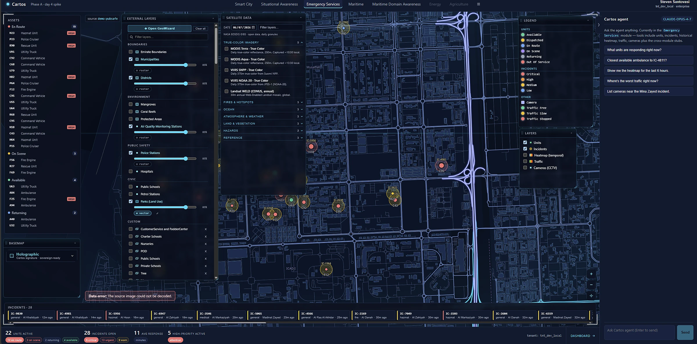
Satellite, 3D, live operations, and an AI analyst on one screen — in the browser, in your own deployment. No GIS experience required.
Commercial model
Five pricing pillars meet customers where they are, from a free first look to a sovereign, cost-plus deployment.
A try-it surface that shows the whole loop on a sample area.
Per-run consumption for compute-heavy analysis, 3D, and capture.
Switch capabilities on per account — buy what you need.
Recurring monitoring, field seats, and a retained intelligence graph.
Sovereign and bespoke deployments, priced on delivered cost.
Design partner program
We're selecting a small number of design partners with a real, recurring geospatial need and sovereignty as a genuine constraint. Early access, roadmap influence, and auditable deliverables for your stakeholders. Engagements run under NDA.